
Weather for
the whole way.
See the weather for the places on your route, at the time you’ll reach them. Check rain, wind and temperature before you leave, then keep the forecast with you.
Free iPhone beta · iOS 26+
A little foresight. A better prepared drive.
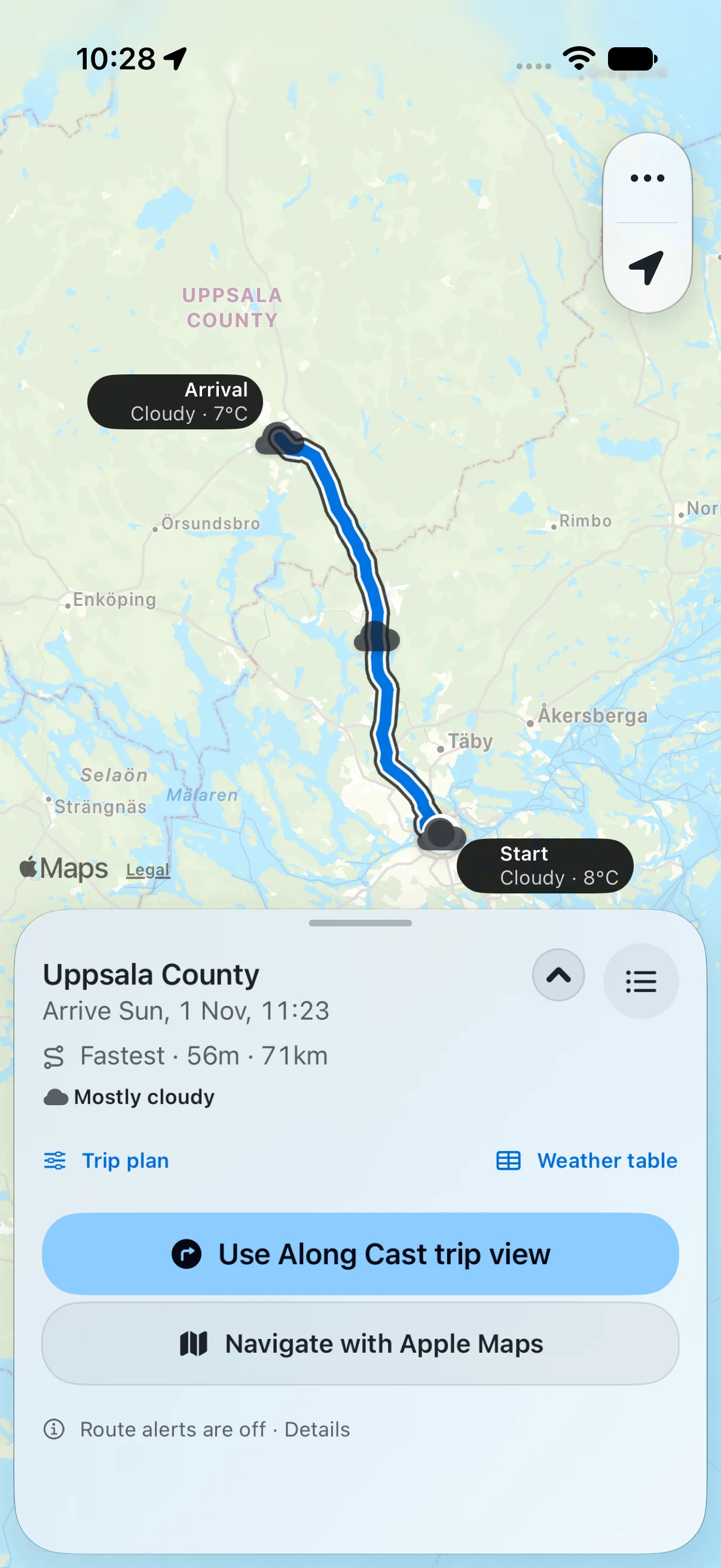 View screenshot
About these screenshots
Your destination is only part of the forecast.
- Apple Maps routes
- Open-Meteo forecasts
- Swedish road context
01 Before you leave
Your route.
Your forecast.
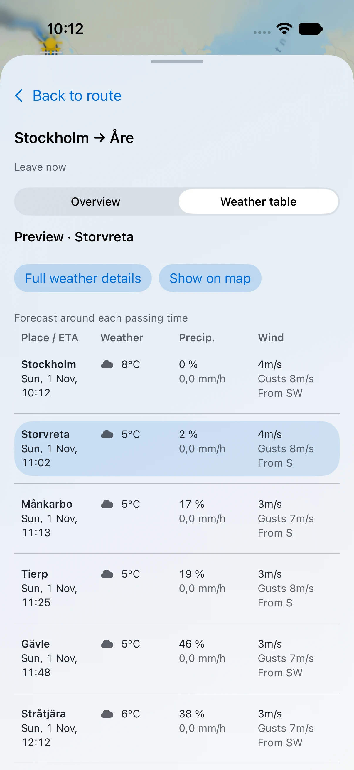
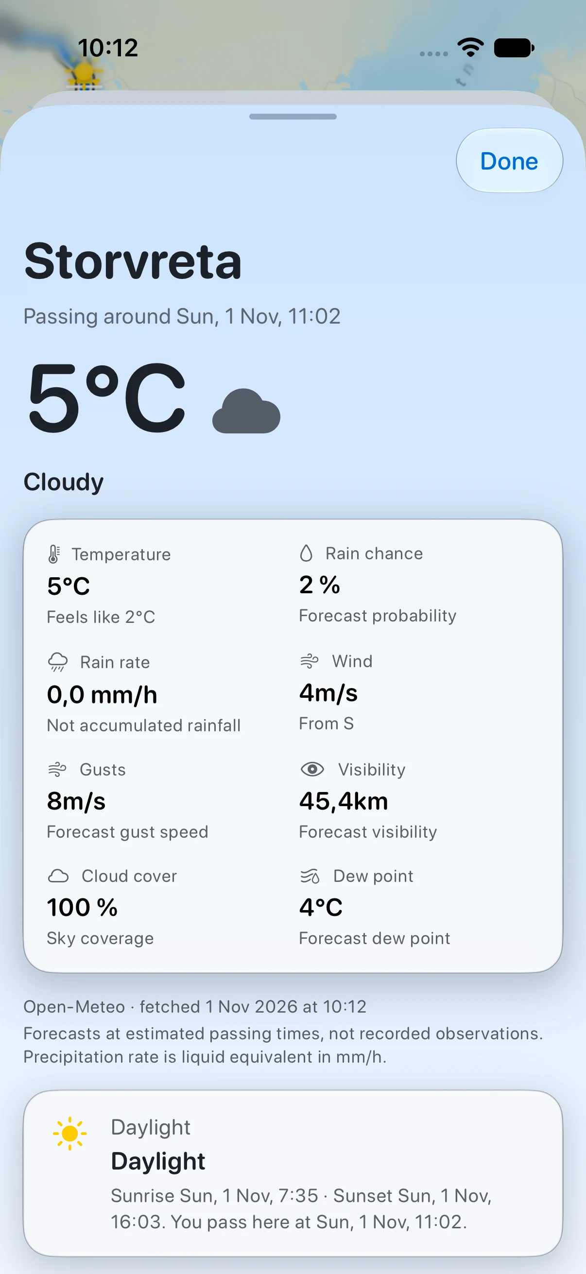
See what to expect at each passing time. Scan the weather table, open the details for any place, and adjust the trip to your plans.
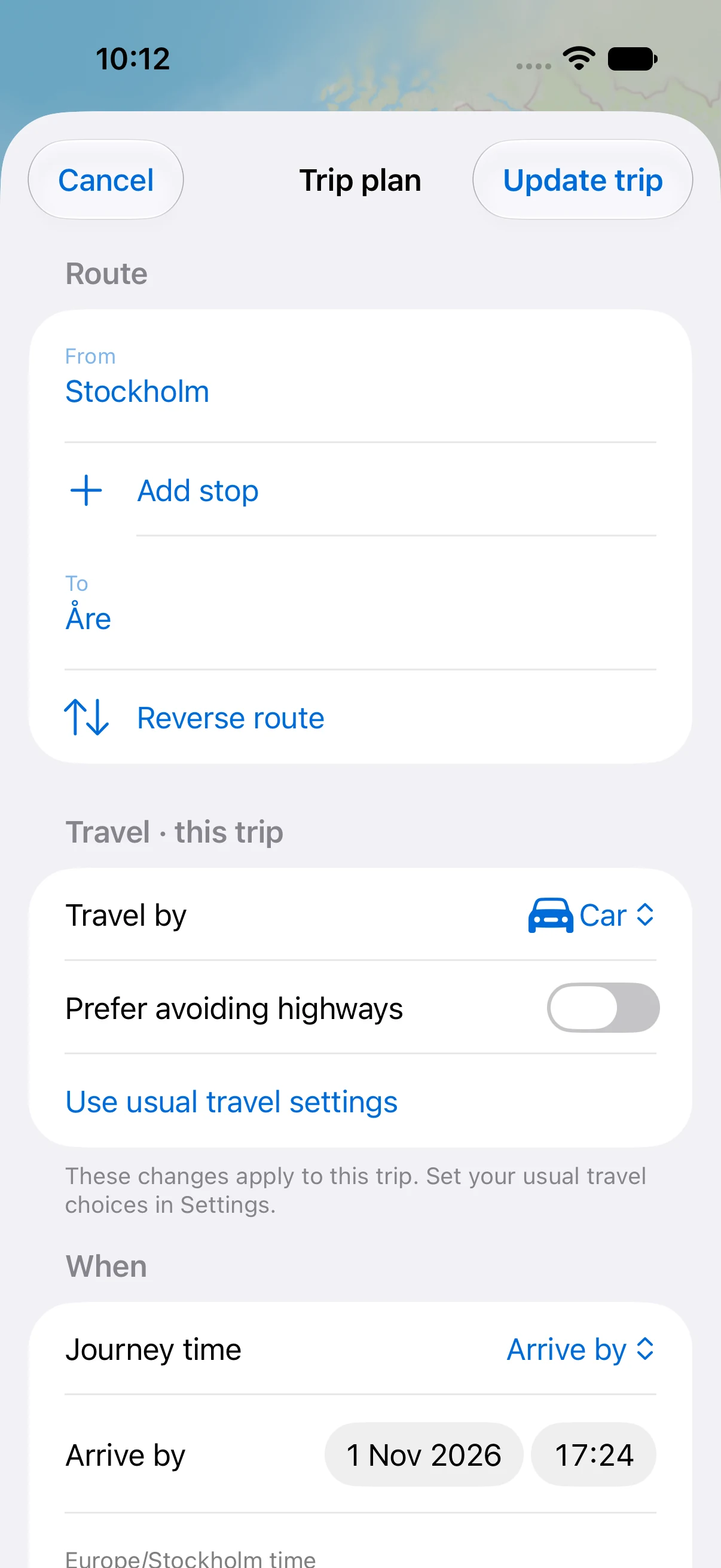
Your route, travel choices and timing belong together. Change them in Trip plan and apply them when you’re ready.
 View screenshot
 View screenshot
 View screenshot
02 Along the road
Keep the forecast
in view.
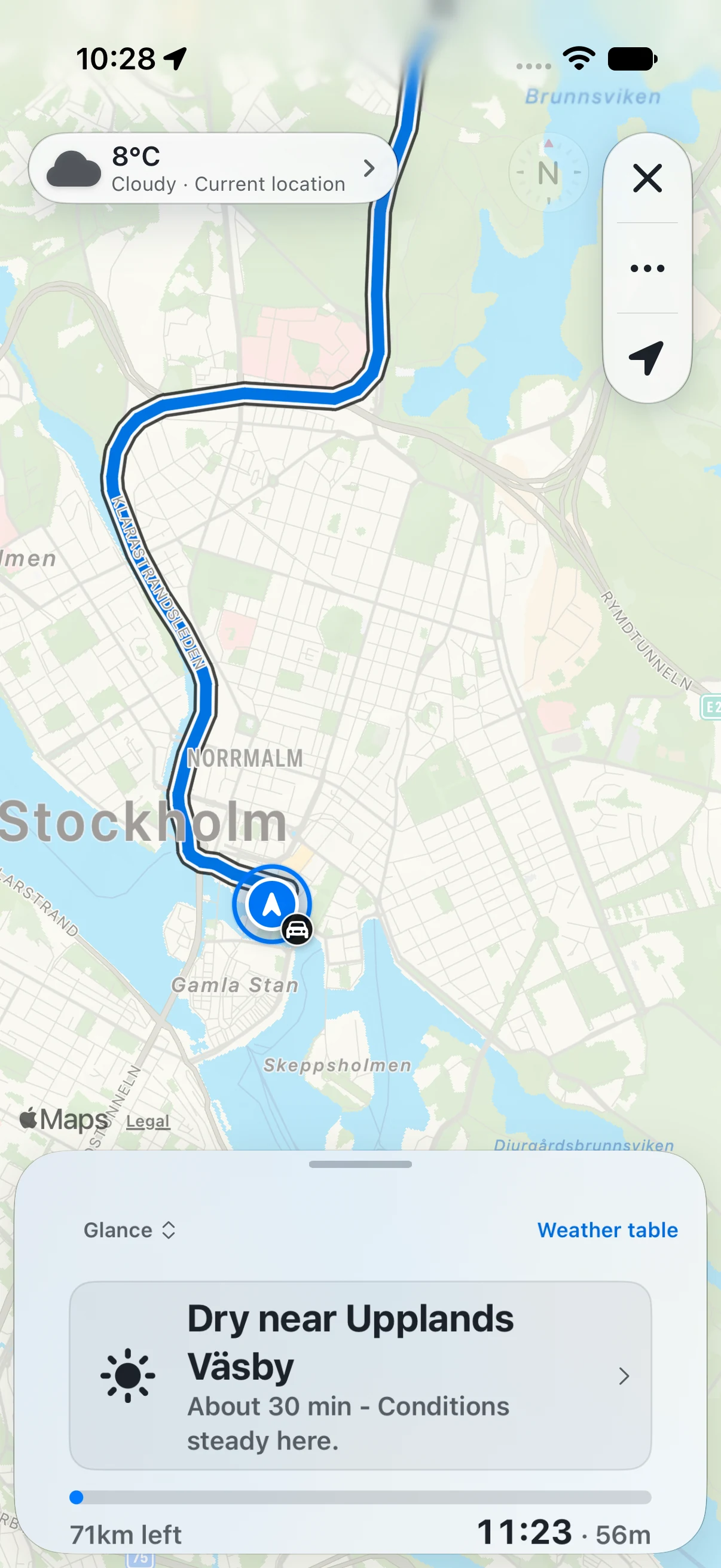
Open the weather table during a trip, preview a place ahead, then return to your live position.
In Sweden, road reports and cameras add context where covered. Open a report for its location and source while parked, or let a passenger take a closer look.
Apple Maps handles the turns.
Open your next leg in Apple Maps for navigation. It calculates its own route, which may differ from the Along Cast plan.
 View screenshot
03 Keep in touch
Your journey.
One simple link.
Send the route and its weather to someone who’s waiting for you. They can open it in a browser, without installing the app.
Live location is a separate choice. Turn it on when you want to share progress, and stop it when you’re done.
You decide what to share.
Anyone with the link can open it. Links expire and can be revoked; precise endpoints are obscured.
Read about sharing and privacy ↗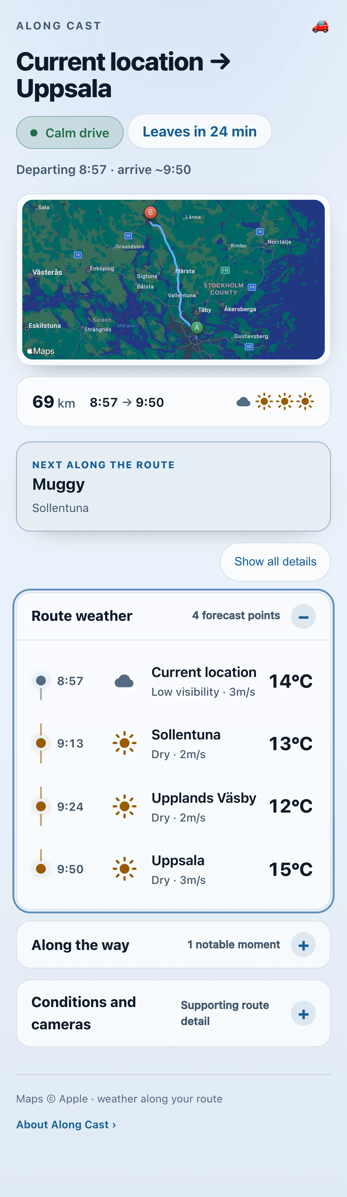 View screenshot
Good to know.
How do I change a trip?
Open Trip plan to change the route, travel settings or timing. Choose Now, Leave at or Arrive by, then tap Update trip. These choices apply to this trip; set your usual travel choices in Settings.
What does the weather table show?
Places along your route and their estimated passing times, with temperature, forecast symbols, rain chance, precipitation rate, wind direction and gusts. Open a row for full weather details. The table is available before you leave and from the trip view.
Where can I use Along Cast?
Route planning and forecasts depend on Apple Maps and weather coverage for your journey. Trafikverket road reports and cameras, and SMHI warnings, cover Sweden where available. Missing reports do not mean a road is clear.
Does it replace Apple Maps?
Along Cast helps you plan around the weather and see conditions along the route. Apple Maps handles turn-by-turn navigation and calculates its own route for the next leg.
What do I need?
An iPhone running iOS 26 or later, Apple’s TestFlight app, and an internet connection to fetch routes and forecasts. You can choose endpoints yourself; location permission is needed to use your current position and follow a trip.
Is the beta free?
Yes. The current TestFlight beta is free, and features may change between builds. The beta guide explains how to install and send feedback.
Will it automatically alert me before a trip?
Departure reminders and condition monitoring are separate. Automatic condition checks depend on service availability and a separate opt-in. Check the upcoming-trip card for the latest status; an upcoming trip alone does not mean monitoring is active.
Is my location shared automatically?
No. Creating a journey link and enabling live location are separate actions you choose. You can stop live sharing or revoke the link. Read the privacy details.
App screenshots captured on 1 November 2026 from the UI source used in build 123, with real Apple Maps routes and Open-Meteo forecasts. The shared browser page was captured on 6 September. These are recorded examples; forecasts and arrival estimates change. Build 0.1 (123) is available through the TestFlight invitation below.
Try your next drive.
See it on a road you know.
Get the free iPhone betaiPhone · iOS 26+ · Available through TestFlight
Installation & beta guide ↗ Open TestFlight
Scan with your iPhone
and come along.